Graves Road: I-275 is Growing a New Interchange
August 21, 2020 Leave a comment
NOTE: This post is being actively updated. Check back often!
In 2020, construction on a somewhat long-planned but high velocity upgrade to I-275 in Hebron, Kentucky commenced on what became the first new interchange on Greater Cincinnati’s “Circle Freeway” (nobody calls it that) in over 40 years. We chronicled the progress in this post.
History
Here is an aerial photo of what would be the interchange taken on May 15, 1969 and compared to 2019.

Here is the official update site: https://www.drivingnkyprogress.org/gravesrd

December 16, 2020 Update
Here is a story about the long-term plans for the Graves Road interchange area from WCPO.
You can also access the presentation from today’s I-275/GRAVES ROAD INTERCHANGE STUDY PUBLIC HEARING.
November 13, 2020 Update
KYTC District 6 has announced that I-275 exits will be renumbered due to the opening of the new Graves Road/KY 495 interchange. The Graves Road/KY 495 exits will be numbered as Exit 8. The existing Hebron exits will be renumbered as Exits 6A and 6B.
October 14, 2020 Update
According to the I-275/Graves Road Interchange Study published recently, Graves Road will be designated as a state route. It will be signed as KY 495.
This marks the third exit number that the Hebron exits have had. The original Exits 7A and 7B, which are the most appropriate given the mile marker point, were changed in the mid-2000s to Exits 8A and 8B. This was done to avoid confusion with another Exit 7 on the duplexed section of I-275/I-74 section nearby in Ohio.
September 27, 2020 Update
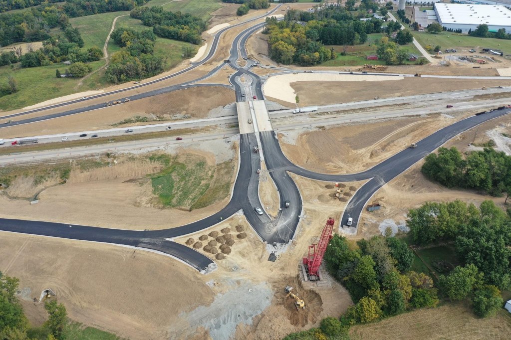
Thanks to the generosity of Rodney Donaldson, we can share these aerial pics of the progress. Huge thank you, Rodney!
Looking north. 
Looking northeast. Global Business Park in distance. 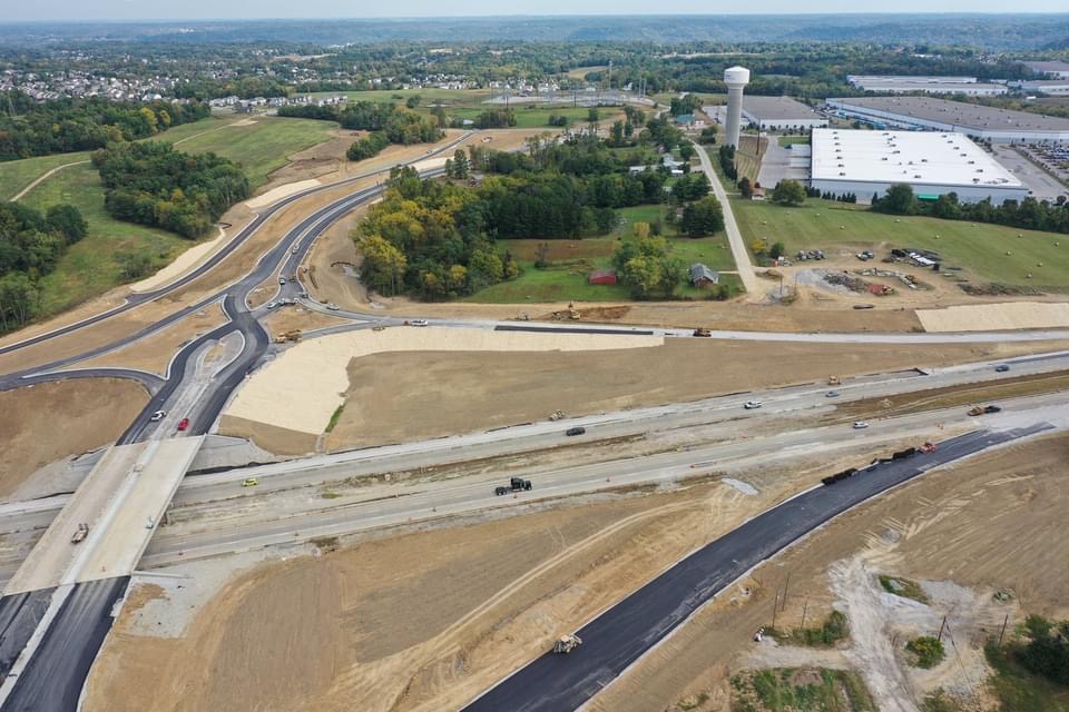
Looking north. Old alignment of Graves is visible on right indicating where old overpass existed. 
Looking west. Residential development in upper righthand corner. Miami Fort Power Station is at top. 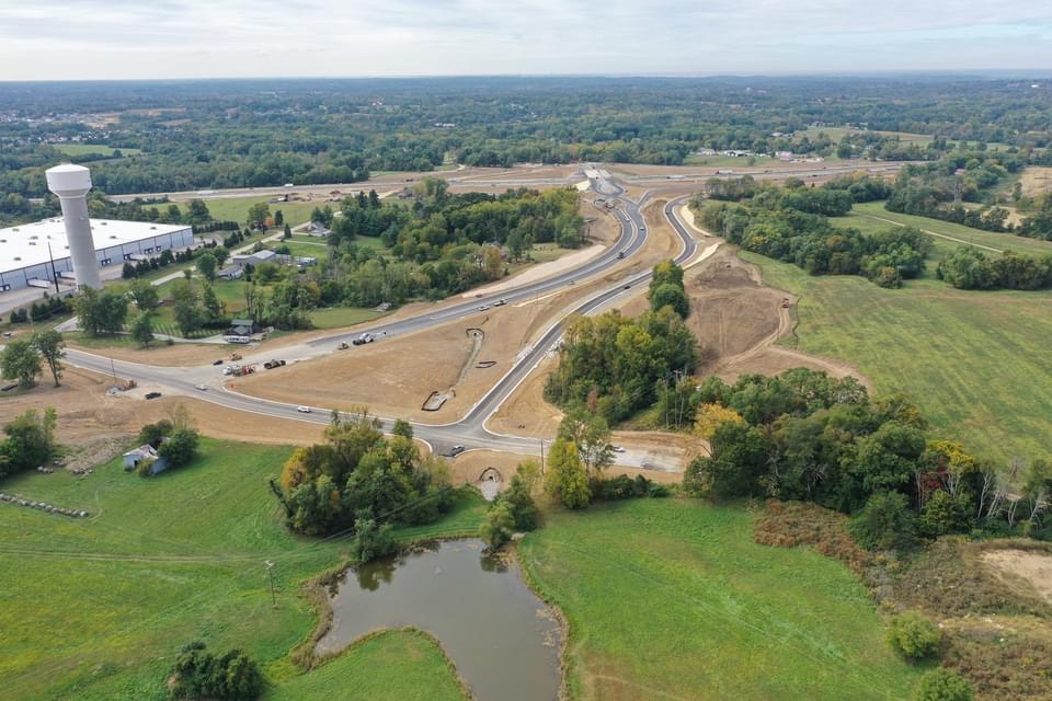
Looking south. The extended Worldwide Boulevard gives access to the newly aligned Williams Road (right) and Graves Road (left). 
Looking east. Worldwide Business Park (Amazon operations, among others) is in the upper lefthand portion of the photo as well as the reconnected Worldwide/Graves/Williams intersections. A realigned Williams Road is to the left now serving as a de facto “frontage” road.
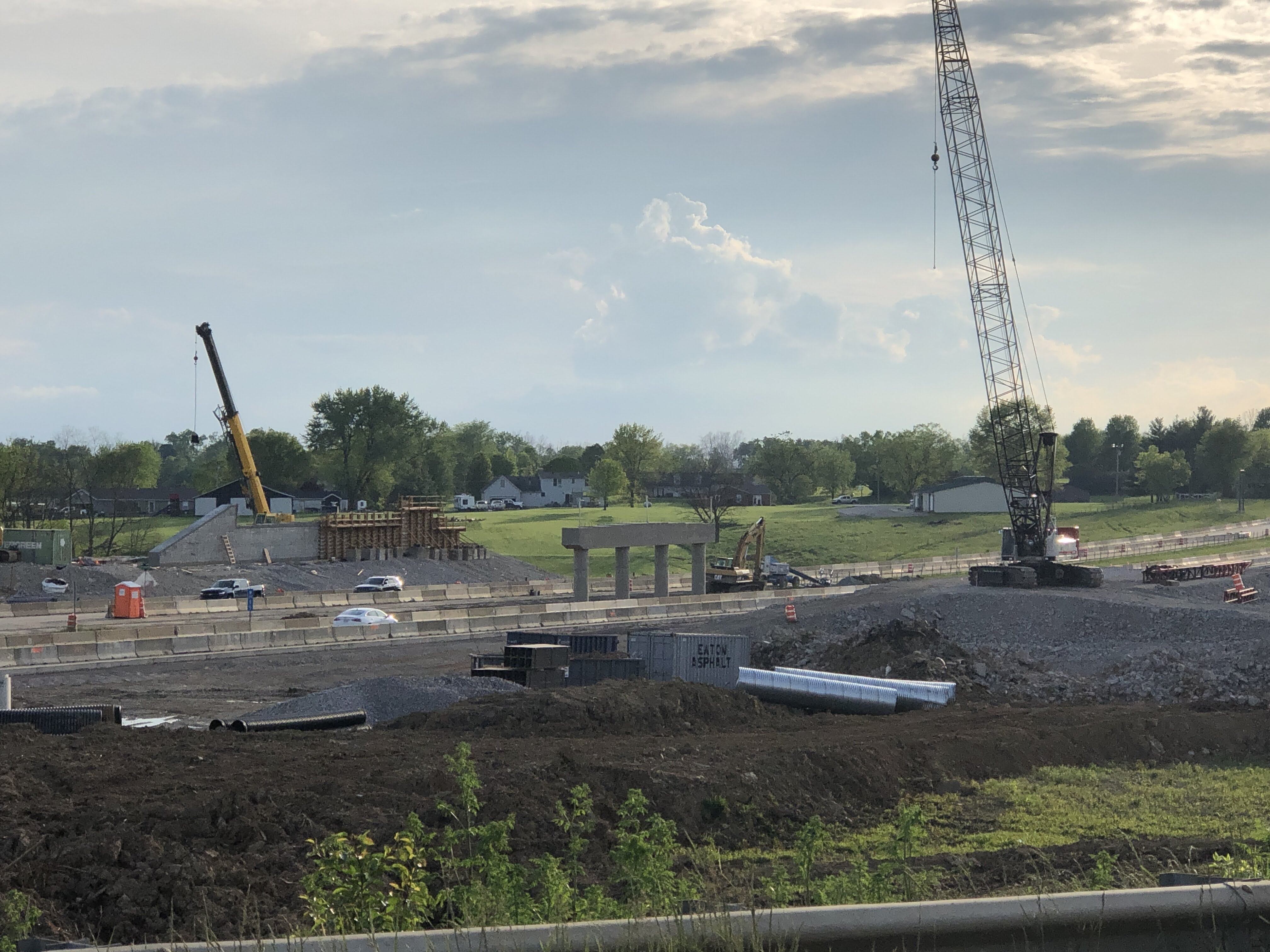
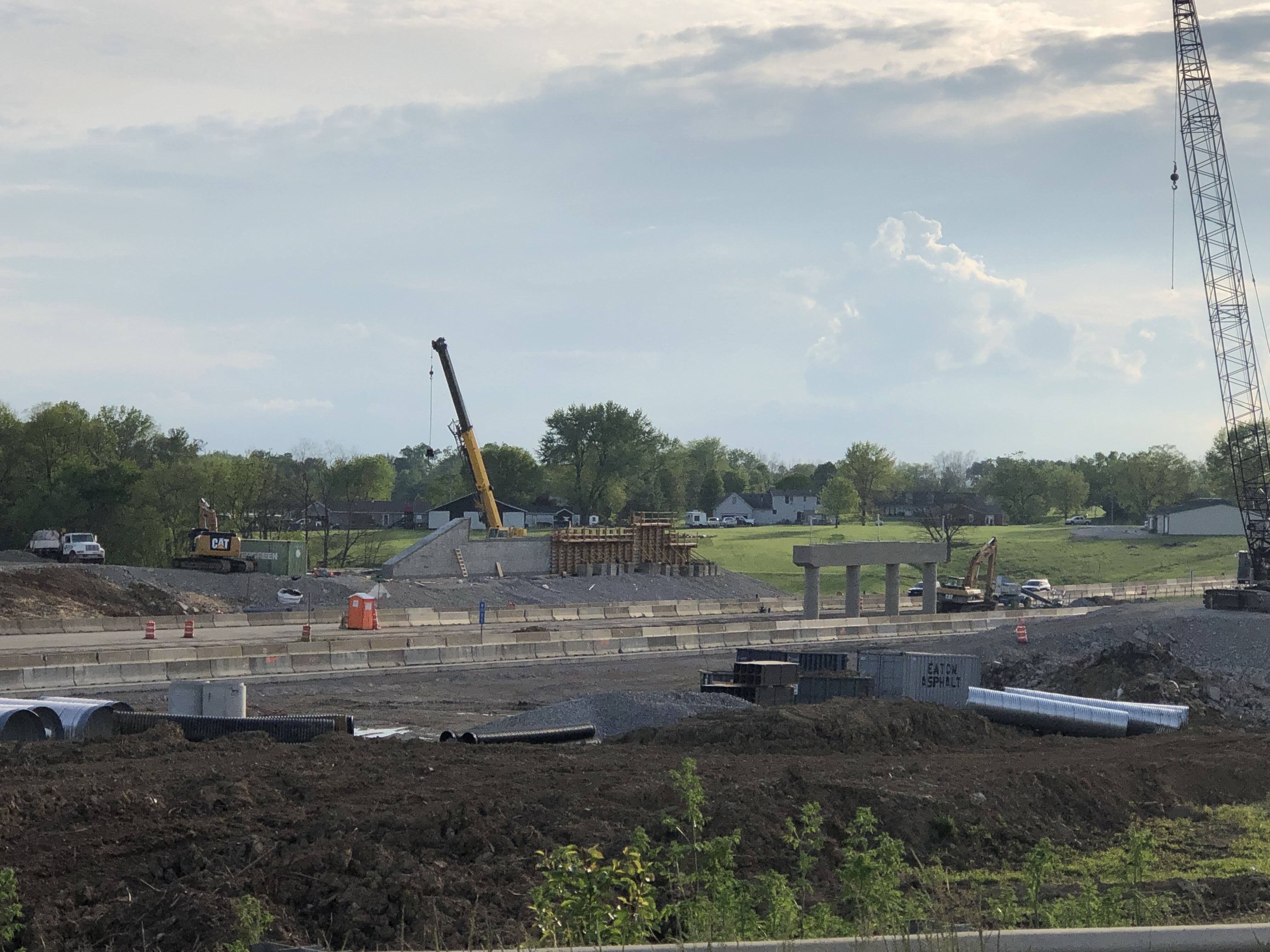
August 13, 2020 Update
In mid-August, crews completed and opened a new Worldwide Boulevard extension to access a new Williams Road and eventually a new Graves Road. This allowed crews to close the old sections of Graves and Williams as well as dismantle the old Graves Road overpass. The new Graves Road is under construction and its opening will coincide with the completion of the overpass and the DCD alignment.
The following are photos taken days after the opening on August 13, 2020.
Above, this shot is looking east and is the new connection of Worldwide Blvd. to New Graves Road and Williams Road. You can see the top of one of the warehouses in the business park which gives an idea of how close development, despite some of these pictures looking rural.

From same spot as previous and is looking along the ROW for new Graves. New Williams can be seen to the right and will serve as a frontage road for new development. We will go there in the following pics.

Same spot again but looking further to the right (SW) at Worldwide extension to New Williams. Note the stubs already in place for future development. Looking further to the right, you would see residential development/construction through the trees…in the Tree Tops subdivision.
We have moved west here to align with the New Williams ROW. Looking south.

Same spot as previous photo but looking back east along the Worldwide extension. The houses on the right will not survive. The building on the left is a Hebron Fire Station.

We have traveled south on New Williams now and are looking SE at the new overpass construction. New Graves will parallel Williams to this vantage point as it approaches the overpass.

Further along the New Williams as we have curved to the SW where the new road joins back with the old road.

Lookin back (NE) the opposite direction of the previous photo. New road meets old and new overpass is in distance. With the new alignment and resulting new access to Old Williams, crews have begun dismantling the original overpass built in the 1970s. It’s just beyond the new overpass.

Now we are looking (west) the opposite direction of the previous photo, but we have moved to the approach of the old Graves overpass and stand in the intersection of Old Graves and Old Williams, which are now completely closed. We are looking along the ROW of Old Williams.

Same view but looking more to the SW.

Turning to our left we are now looking south at Old Graves overpass. I-275 passes in front of us, obscured by the berm.

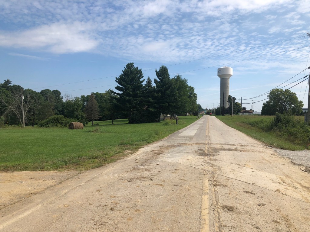
Looking (north) opposite of previous. Alignment of Old Graves. Notice the water tower. We started this tour to the left of it. New Graves will run several hundred feet to the left (west) of this old potion of Graves, which will be gone at some point. This area has all been rezoned commercial/industrial and will be redeveloped.

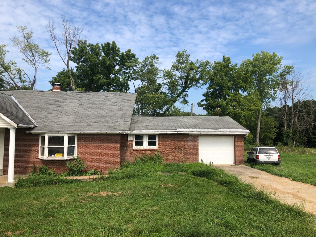
Turning left from the previous pic, this house has sat ambiguously vacant for years. Not for much longer…
June 21, 2020 Update

Looking WB.

North approach.

Looking east on Williams Road

East on WiIliams Road where new approach of Grave Road from north will be located.

Looking east.

Looking west.


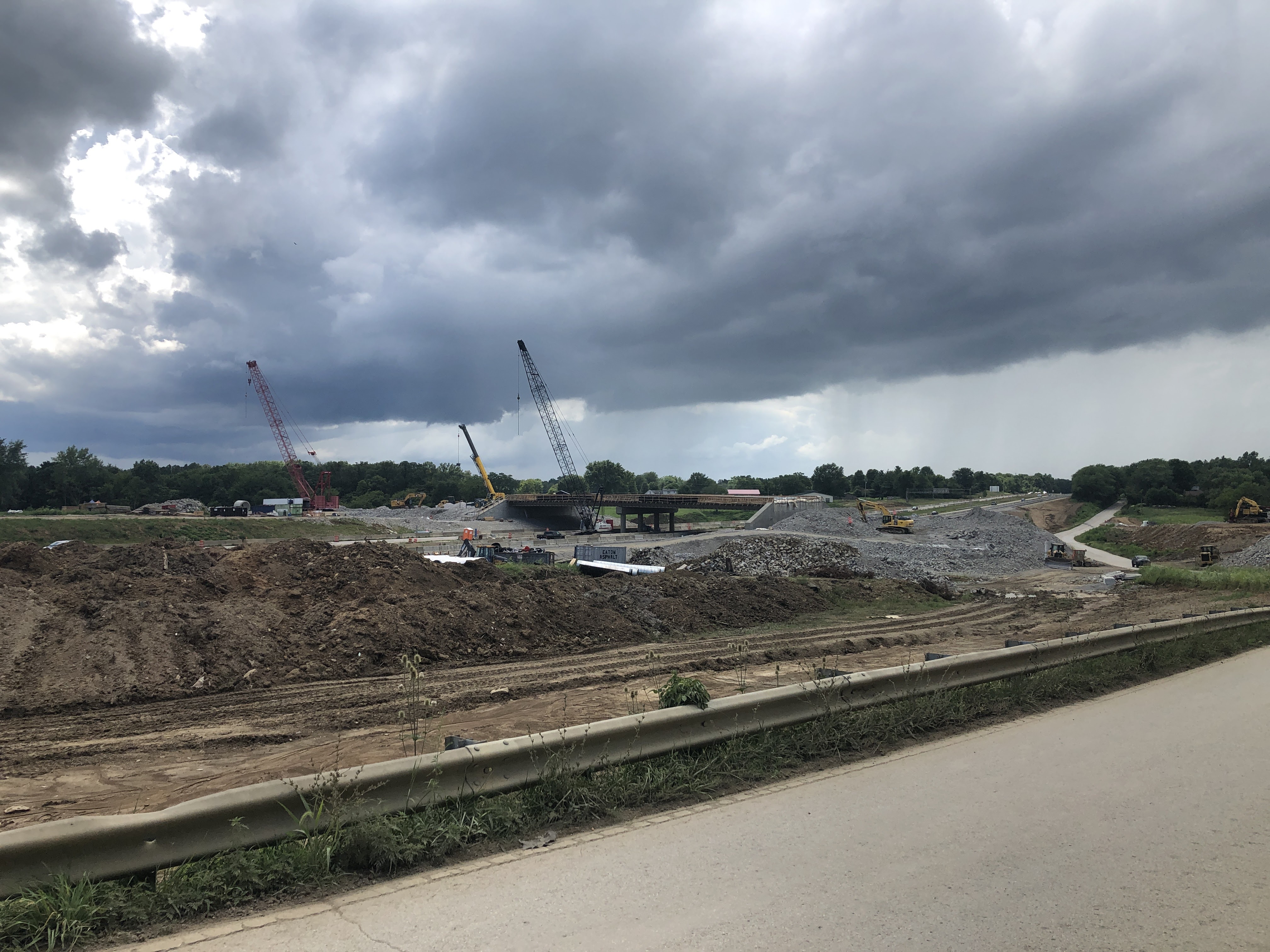
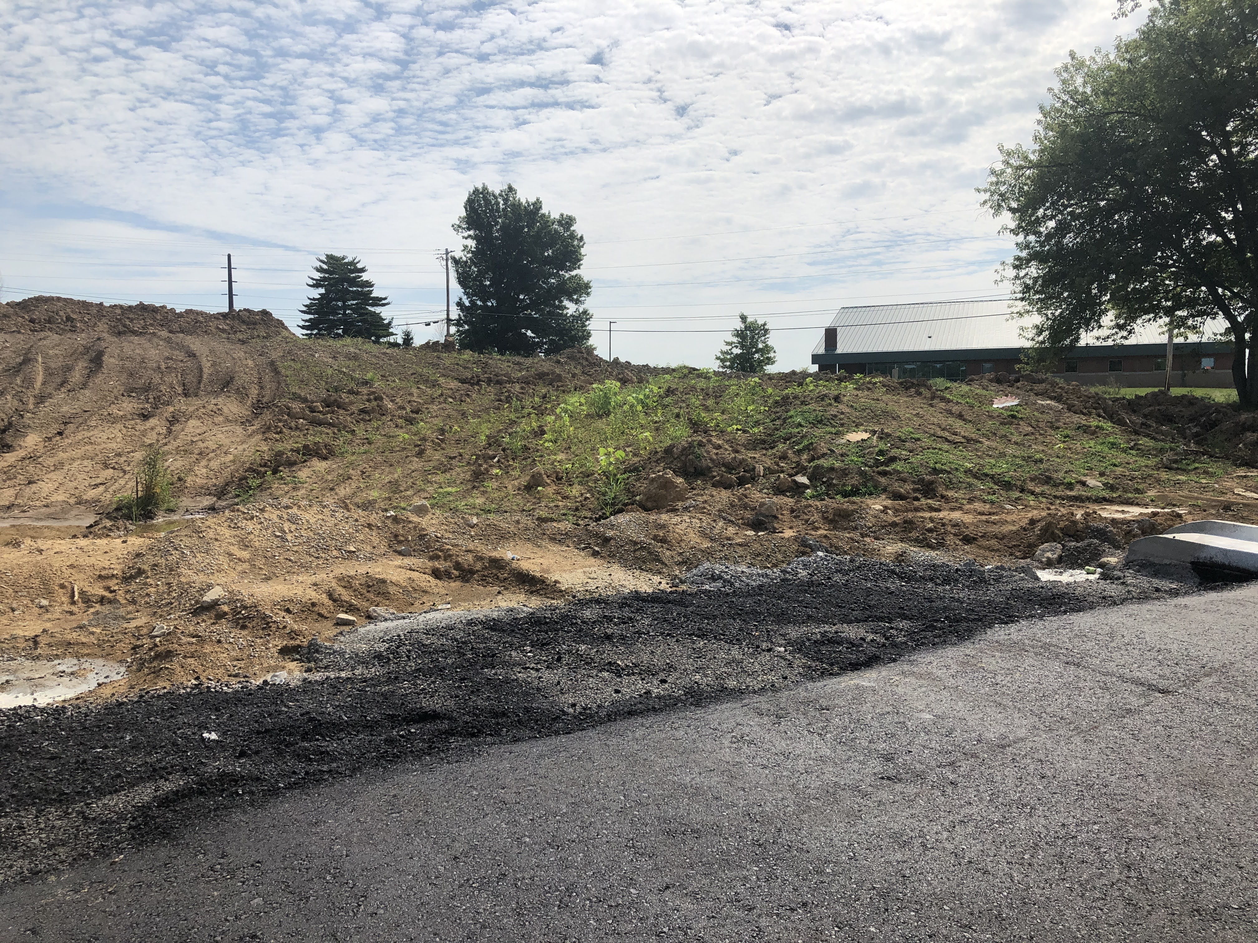
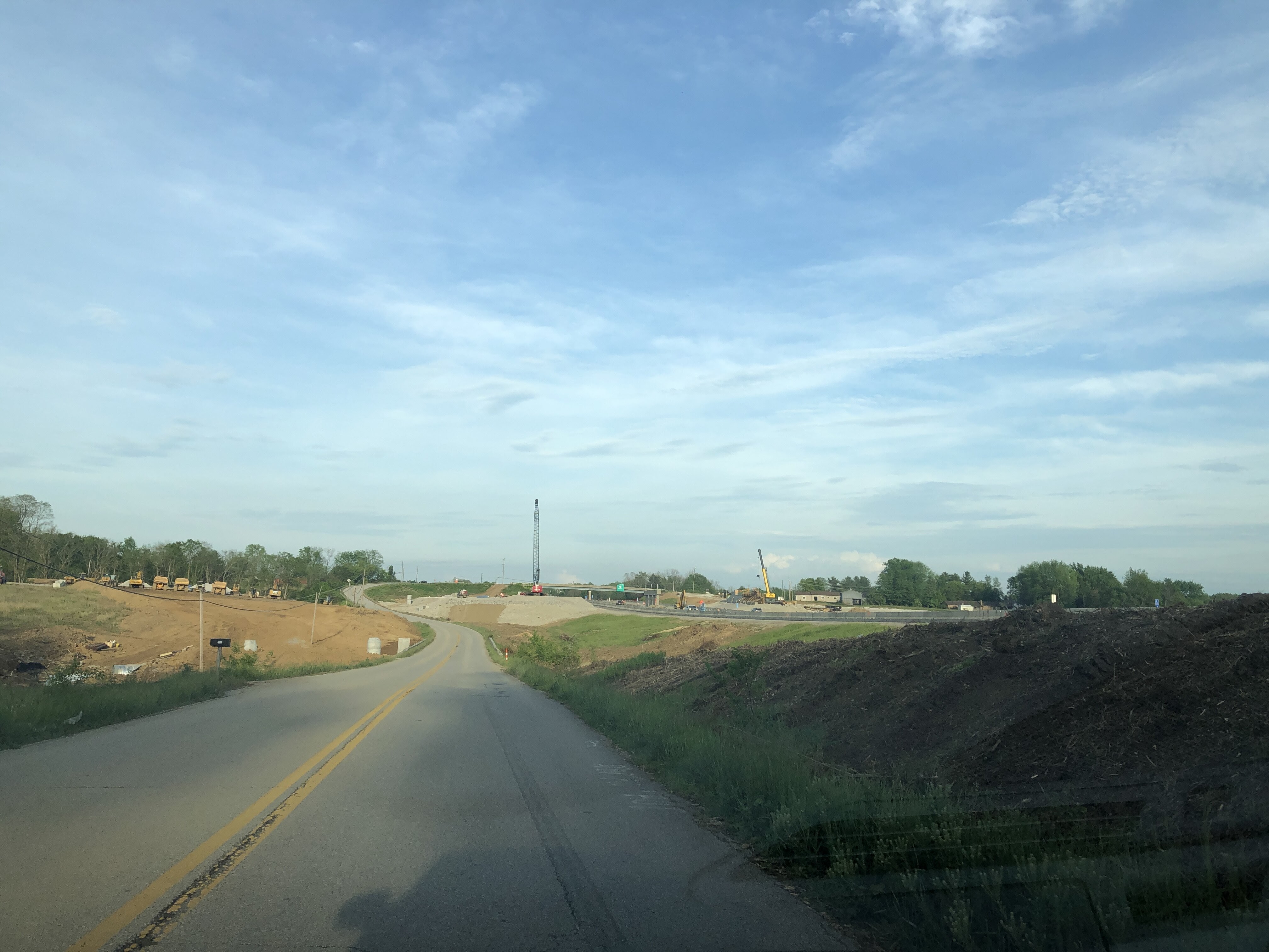
Progress on the new Graves Road interchange on I-275 as of August 1, 2020.
Looking SW toward new overpass.


East toward new alignment of Williams Road which will function as frontage road for new Graves Road and then connect to the original alignment for access to residential areas to north and west.

East toward overpass and new alignment of Williams Road which will function as frontage road for new Graves Road and then connect to the original alignment for access to residential areas to north and west. New WB entrance ramp will run just to right of new Williams Road and roughly in alignment with existing Williams Road. Note?: This road surface and alignment dates back to original construction of I-275 here. It served as a new access to what was a section of Watts Road that was cutoff by I-275.


Looking East. Closer view of fill that will raise new Graves Road and the DCD to the level of the overpass. This section will close once the new Williams connector is finished. I have no authority but I would bet this will happen mid-August that old Williams will be permanently closed and as a result the access to the old Graves overpass that has been “closed” (locals are still using it) since early 2020, will be scheduled for demolition.

June 4, 2020 Update
Lots of fill and grading happening for this whole project since the realigned Graves Road is mostly being moved into a lower area of the terrain that includes a tributary of Woolper Creek.

May 16, 2020 Update
This project is flying along as expected.


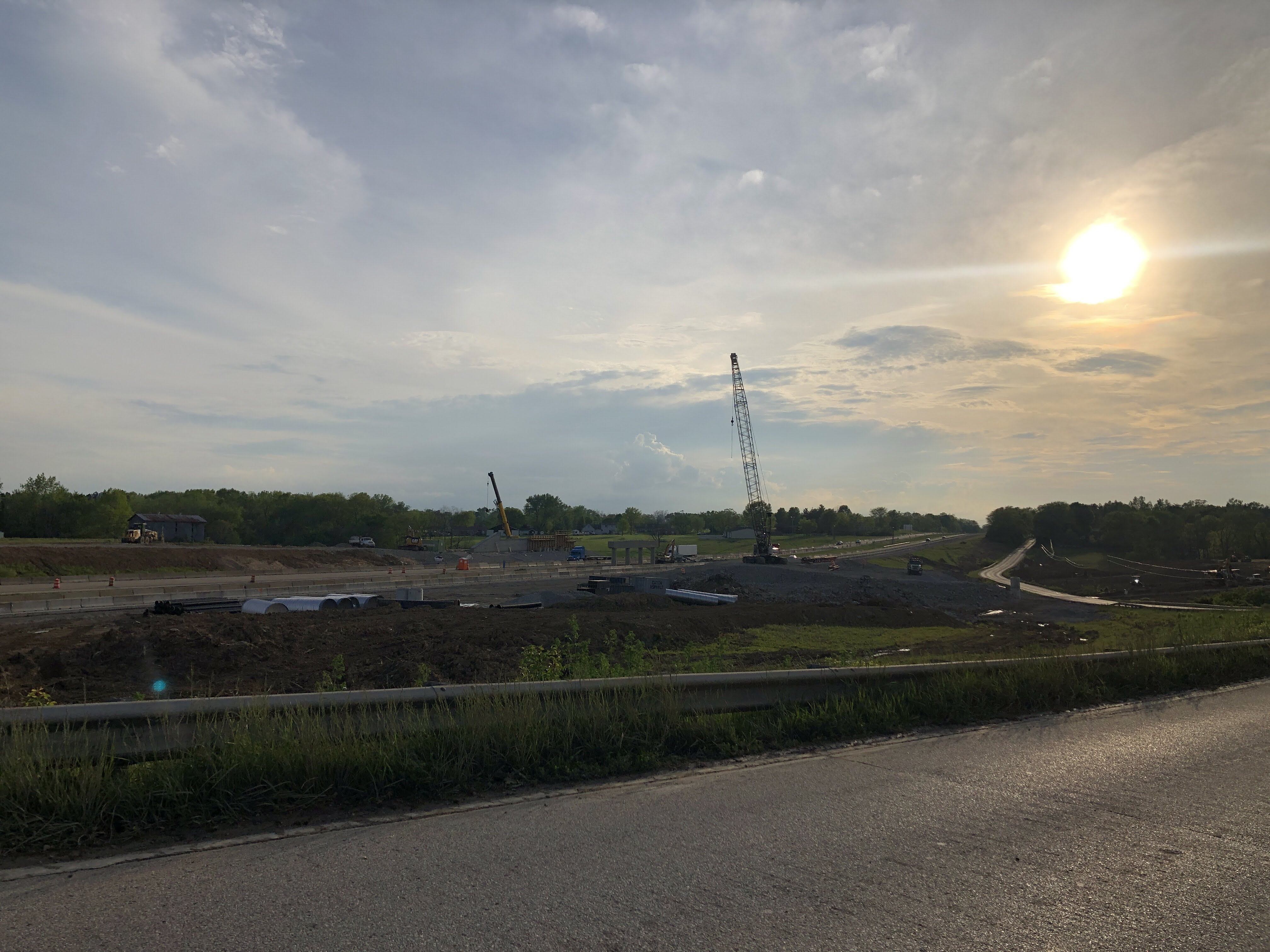
April 14, 2020 Update
Here are PE’s own pictures (except where noted…thanks fans!) of the new Graves Road interchange (Exit 9?) on I-275. Edit: In 2020, we speculated that the new exit number would be 9. The exit was eventually numbered 8 in December, 2022 and KY 273/Hebron was renumbered to Exit 6 subsequent to being renumbered Exit 8 sometime in 2003. This marked the possible(?) end to years of jumbling exit numbers on this section of I-275. When opened in the 1970s, the KY 237/Hebron exit was numbered Exit 7. Over the years this created confusion as I-275 already had an Exit 7 in Ohio where it was multiplexed with I-74 and thus used the I-74 mile markers to inform the exit number, resulting in two Exit 7s on what is essentially the same route.
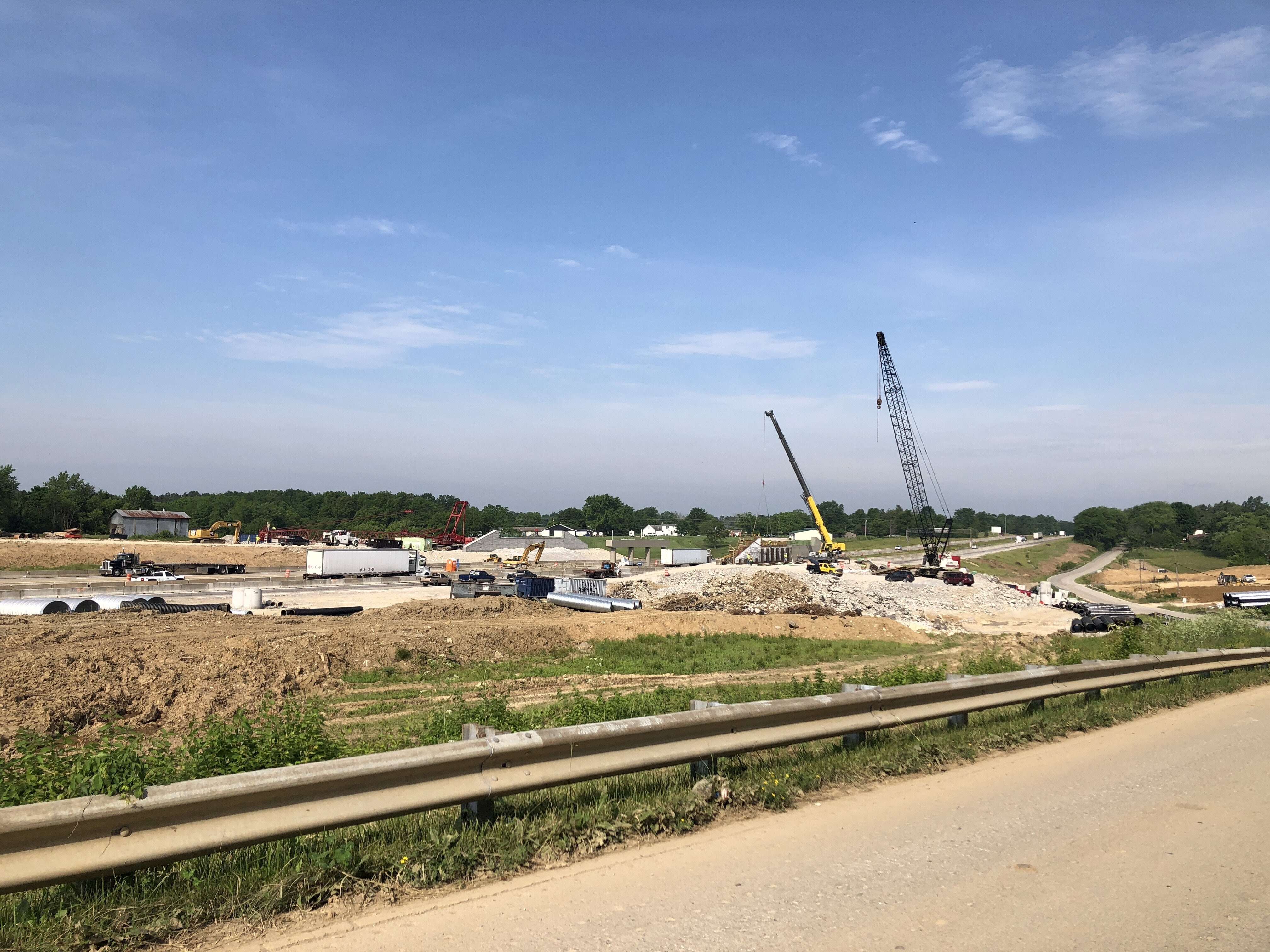
Looking southeast at old overpass.


Looking southwest toward new overpass construction. Williams Road is in the foreground. This section of Williams was a realignment necessitated by the original construction of 275 in the late-1970s. You can see it appear in the animated comparison shot at the beginning of this post. The resulting “stub” south of the freeway cut off by the construction of I-275 was renamed Watts Road.

Looking southeast toward old overpass.

Looking south toward new overpass construction.

Looking southwest toward ramp construction.